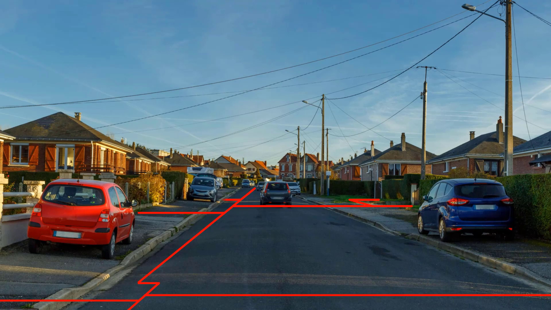
Visualize all the underground networks of a site with the "Augmented Reality" add-on

Make F3D more profitable by adding new features!
Add-on Augmented Reality by vGIS

Embrace an approach that’s not only enriched but also insightful, secure, and highly effective.
Crafted to overcome visual barriers, our technology empowers users with their provided F3D mobile device to seamlessly visualize georeferenced and cross-referenced networks in real time. Beyond mere sight, this tool illuminates the intricate layout of underground infrastructures and concealed challenges, offering users a depth of understanding previously unreachable.
Highlighting what usually remains unseen, our solution dramatically boosts the safety of workers and bystanders alike. This enables operators to navigate their environment with heightened awareness, significantly cutting down on potential mishaps and network damages on site. Moreover, operators have the flexibility to tweak the layout on-the-fly if onsite observations differ. And, when required, adjustments can be overseen by the Surveyor.